Waypoint Geographic World/USA Tracing Activity Book
Item #:
901-24529148
Model #:
RWPTA01
Brand:
Round World Products
Not yet rated. Be the first to
Write a review!


$9.89
Per each
Upgrade to get 5% off, earn points 10% faster and more.
Waypoint Geographic World/USA Tracing Activity Book
Customers also viewed

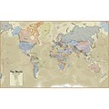
Hemispheres® Boardroom Series World Laminated Wall Map, 38" x 61" (RWPHM03)
Item #: 901-24519762
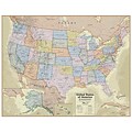
Hemispheres® Boardroom Series United States Laminated Wall Map, 38" x 48" (RWPHM04)
Item #: 901-24519761


Waypoint Geographic 4" Diameter Blue Ocean GyroGlobe, Pack of 2 (RWPWP50200-2)
Item #: 901-24515200
Description
Learn where countries and continents of the World are located by tracing these tear-out maps. This activity book includes 36 perforated sheets of 8.5" x 11" tracing paper. The 9 maps to be traced include one each of the 7 continents, plus one of the USA and one of the World. Tracing paper accepts pencil, pen, and marker.
- Activity book to help your child learn where countries and continents of the World are located.
- 7+ years
- This activity book includes 36 perforated sheets of 8.5" x 11" tracing paper.
- Tracing paper accepts pencil, pen and markers.
- Continents, Countries and US States are labeled.
Specifications
Book Topic
Geography
Brand
Round World Products
Media Format
Printed Book
School Grade
Elementary
Type of Book
Activity Book